
Features TdhZones
TdhZones reports location relative to defined polygons (geofencing) using coordinates obtained from the device on which the app is running.
Polygons used by TdhZones are defined within an sqlite database that may be created, viewed and edited using the TdhGIS personal computer software.
Coordinates used by the polygons may be longitude/latitude or any coordinates that can be obtained by converting from long/lat data using the Proj4 library.A typical use of TdhZones would be determining the name of the state where the device is located or is nearest to.This local version stores the geo database and performs the spatial analysis on the mobile device.
Food & Dining
Discover recipes and order food from your favorite restaurants.
Shopping Features
Shop online and find the best deals.
Smart Home
Control and monitor your home with smart features.
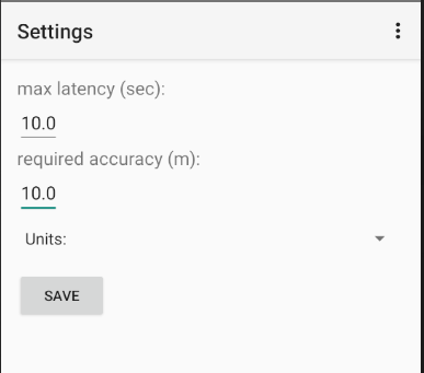
See the TdhZones in Action
Get the App Today
Available for Android 8.0 and above